

Drinking water source protection is about keeping municipal water supplies safe and abundant, now and into the future. By taking the right actions, we can protect municipal drinking water sources from contamination and overuse.
Better protection of drinking water sources prevents contamination in the first place, reducing costs of treatment required to supply water safe for consumption.
Crowe Valley Source Protection Area
4 municipal drinking water systems are within the Crowe Valley Source Protection Area, belonging to 3 municipalities:
|
Municipality |
Drinking Water System(s) |
Source(s) |
|
Highlands East |
Cardiff → |
Well
Well |
|
Havelock-Belmont-Methuen (HBM) |
3 Wells | |
|
Marmora & Lake |
Surface Water Intake |
The Marmora and Lake drinking water system draws its supply from a surface intake on the Crowe River. HBM and Highlands East draw water from municipally operated groundwater wells.
Click on the name of the drinking water system above to see its location and surrounding vulnerable areas.
Vulnerable Areas – What They Are & Do You Live in One?
Certain activities in Vulnerable Areas can be threats to the health of municipal drinking water and our communities.
People within vulnerable areas have a special responsibility to help protect sources of drinking water for everyone – everyone lives downstream.
Under the Clean Water Act, policies and tools are applied to manage and protect Vulnerable Areas around sources of municipal drinking water. The images below depict how the protection areas for groundwater (wells) and surface water (intakes) work.
See if you are in a vulnerable area and which policies may apply, click here.
GROUNDWATER (Wellhead Protection Areas)
Applies to: HBM and Highlands East
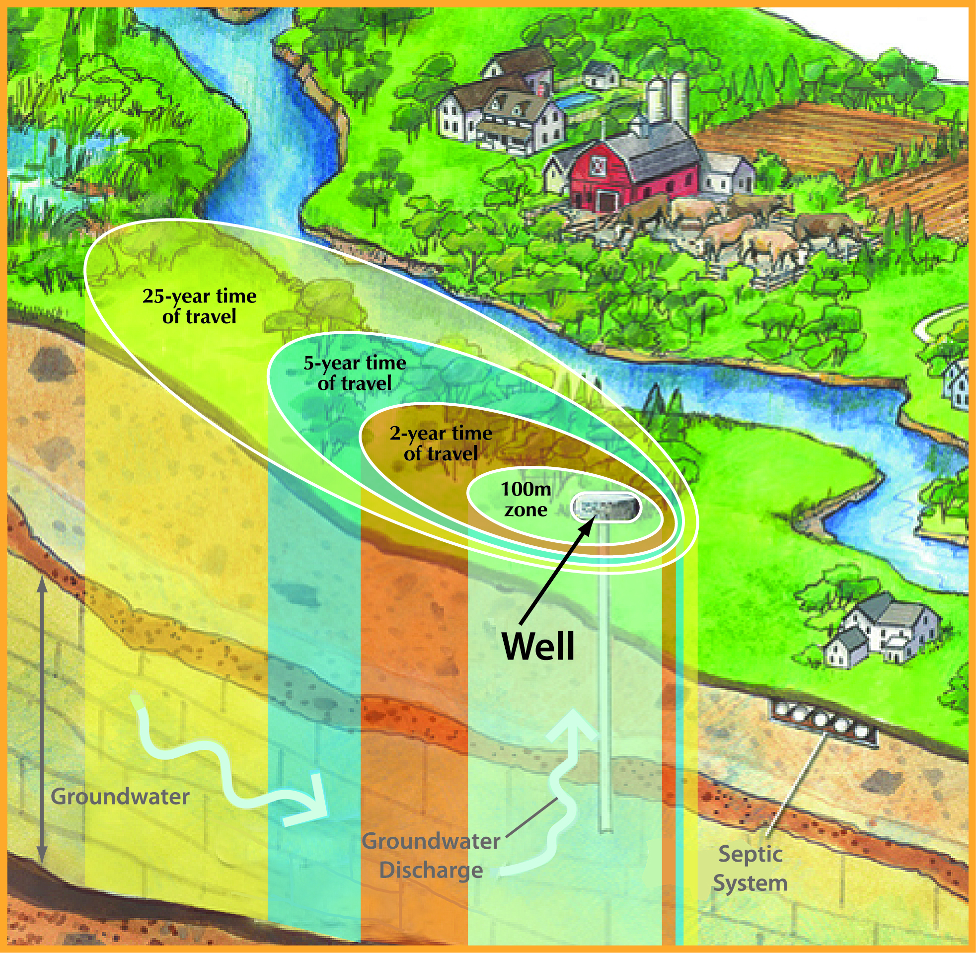
The amount of land involved in a wellhead protection area is determined by a variety of factors such as the way the land rises or falls, the amount of water being pumped, the type of aquifer, the type of soil surrounding the well, and the direction and speed that groundwater travels. All of these factors help to determine how long it takes water to move underground to the well itself and how much land around the wellhead should be protected.
SURFACE WATER (Intake Protection Zones)
Applies to: Marmora & Lake
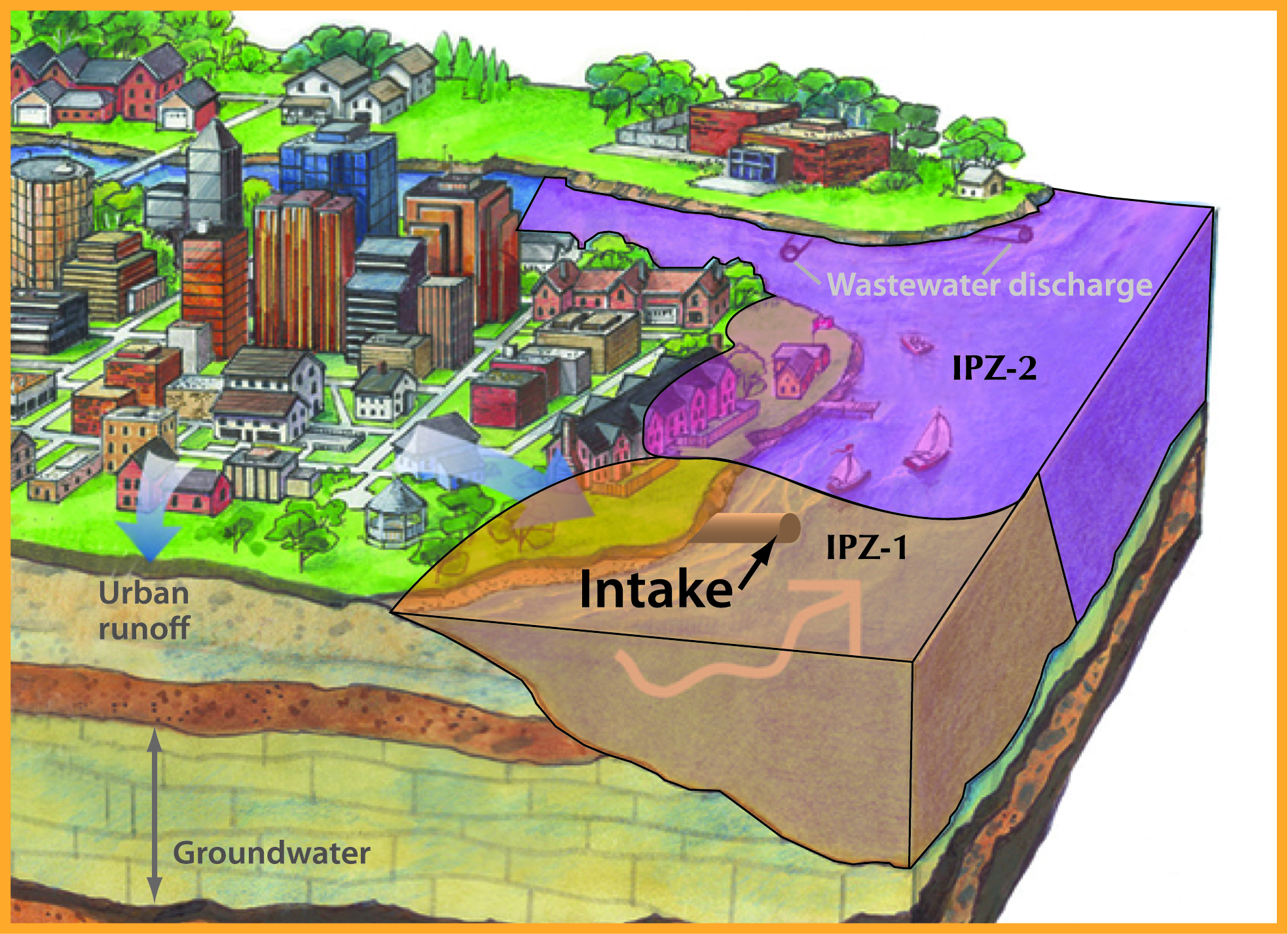
The area of water and land within an intake protection zone is determined by a variety of factors such as the amount of time it would take any material spilled in or near the river to flow downstream to the water intake. This is called the time of travel. A fast or slow flowing river can change the area of an intake protection zone significantly. River flows, streams feeding into the river or lake, and the location of municipal storm sewers or rural drains are all considered when determining an intake protection zone since they all affect time of travel.
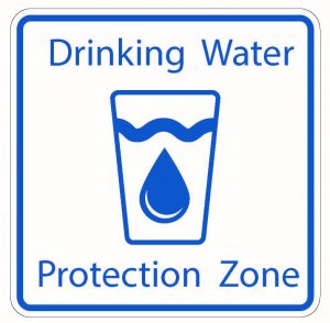
New Signs
Signs are placed along Ontario’s roadways to make people aware of areas where extra care is needed to protect municipal drinking water sources.
In the event of a spill within a Drinking Water Protection Zone, residents can call emergency responders (9-1-1) or the Ontario Spills Action Centre (1-800-268-6060).
You Can Help
From individual actions, such as taking used engine oil and other household hazardous wastes to proper disposal sites, to collective efforts as whole communities, we all have an important role to play in protecting municipal drinking water sources.
If you discover something that could be a threat to a drinking water source, please contact your local Source Protection Risk Management Official (RMO):
Crowe Valley Source Protection Area
E: | T: (613) 472-3137
Moving Forward
Everyone lives downstream. We all have a role to play in caring for our water. If we want clean water tomorrow, we need to protect our sources of water today.
Please visit the Trent Conservation Coalition Source Protection Region’s website for up-to-date information about drinking water source protection and activities.
![]()
![]()