What areas are regulated?
Regulated areas include the land in or near rivers, streams, ponds, wetlands, slopes, and floodplains. Examples include:
- Within 15m of the floodplain associated with the following watercourses and waterbodies: Beaver Creek, Belmont Lake, Cordova Lake, Crowe Lake, Crowe River, Kasshabog Lake, Limerick Lake, Paudash Lake, Round Lake, St. Ola Lake and Wollaston Lake
- Within 30 m of the top of a bank of any watercourse or water body not listed above
- Within 120 m of a Provincially Significant Wetland & all wetlands 2 hectares or greater
- Within 30 m of all other wetlands less than 2 acres
What is development?
In short, development under the Conservation Authorities Act is considered to be any filling, grading,
excavating or construction activities within the CVCA’s regulated area. As defined in the Conservation
Authorities Act development is:
(a) the construction, reconstruction, erection or placing of a building or structure of any kind,
(b) any change to a building or structure that would have the effect of altering the use or potential use
of the building or structure, increasing the size of the building or structure or increasing the number of
dwelling units in the building or structure,
(c) site grading, or
(d) the temporary or permanent placing, dumping or removal of any material, originating on the site or
elsewhere; (“aménagement”)
What is a natural feature?
A natural feature is a feature found on the landscape that is naturally occurring. Examples of natural
features are: lakes, rivers, streams, creeks, wetlands and steep slopes.
I want to develop my property - what should I do and when?
I want to develop my property - what should I do and when?
If you are thinking about completing any development (construction/filling/grading/excavating)
activities on your property, please refer to the below for suggested step by step instructions.:
1. Submit a Property Inquiry Form
Submit a Property Inquiry Form (PIF) as soon as you start thinking about a development project
on your property. This helps to determine if your proposed development requires a permit from
the CVCA, if further information, such as an elevation survey or environmental impact study, is
required or if a site visit would be valuable to help assess the property for the proposed or
future development. The early submission of the PIF allows for any changes to your proposed
development to be addressed before you spend money and time on expensive drawings.
2. Contact the municipality.
3. Submit a permit to the CVCA Office.
What is the difference between the regulated are and a setback?
The regulated area is the area around a natural feature that the CVCA regulates and a permit is
required for any development activities within the regulated area. For example, the CVCA may regulate
30 meters from a wetland. A setback is the distance between a natural feature and where development
may be restricted or prohibited. For example, the CVCA may apply a 15 metre “no development zone”
setback from a wetland, this is the area where development may be restricted or prohibited.
What happens if my property is within the regulatory floodplain?
If your property is within the regulatory floodplain an elevation survey, completed by an Ontario
Land Surveyor, will likely be required as part of your permit application and proposed development will
likely be subject to size limitations and will be required to be floodproofed.
What are examples of projects that could require a permit?
Examples of activities requiring approval within regulated areas include, but are not limited to:
- Construction, reconstruction or placing a building or structure of any kind
- Any change to a building or structure that changes its use, increases its size or increases the number of dwelling units
- Grading of the site
- Temporary or permanent placing, dumping or removal of material originating on site or elsewhere
- Alteration to watercourses, bridges, culverts and other infrastructure; and channel and shoreline alterations
- All works in the water, e.g. docks, boathouses, dredging, etc.
How do I file an application?
Permit applications can be filled out online and emailed to or filled out at our office and submitted to one of our Regulations Officers.
How much does a permit cost?
The cost of a permit depends on the type of project and how complex it is. Please see our Permit Fee Schedule for more information.
What if my permit is rejected?
CVCA regulations officers will work with applicants to help develop plans so they meet the regulation. In rare cases, if an application does not meet CVCA’s policies, a hearing may be held before the CVCA Board of Directors to determine if the permit can be issued.
What if I have done work/started work without a permit?
Any development where work that has been done or started is deemed a violation.
When CVCA staff learn that a violation has taken place, they will discuss the situation with the landowner. CVCA attempts to address minor infractions by working with cooperative landowners to go through the permit process or develop a plan to restore the property.
If CVCA issues a permit after work has already started, a non-compliance fee is issued (double the regular fee).
If CVCA and the landowner cannot work out a solution, legal action can be taken. The landowner may be charged and taken to court. If convicted, the court may require the landowner to pay a fine and restore the land to its original condition, at the landowner's cost. That could include removing a structure, removing fill or restoring a natural feature such as a wetland.
More information can be found here.
When do I need to contact the CVCA?
The earlier the better. Never assume you don’t need a permit. Please contact our office so we can conduct a more detailed assessment of permit requirements.
What is the difference between the ordinary high water mark and the regulatory floodplain (100-year flood event)?
The ordinary high water mark is a visible mark on the shoreline where a change in vegetation or soil can be observed. This mark is made by average flood events such as the spring freshet or average high water conditions. This is the highest point consistently achieved year after year. The 100-year flood event is a frequency based flood event that is determined through analysis of precipitation, snow melt, or a combination thereof, having a return period (or a probability of occurrence) of once every 100 years on average (or having a 1% chance of occurring or being exceeded in any given year). The 100-year flood event is the minimum acceptable standard for defining the Regulatory floodplain and is an elevation. The regulatory floodplain will exceed the high water mark.
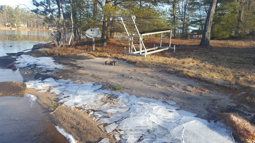
Originally high water mark showing change in soil & vegetation
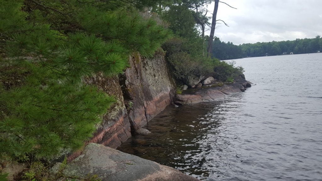
Originally high water mark showing mark on rocks.
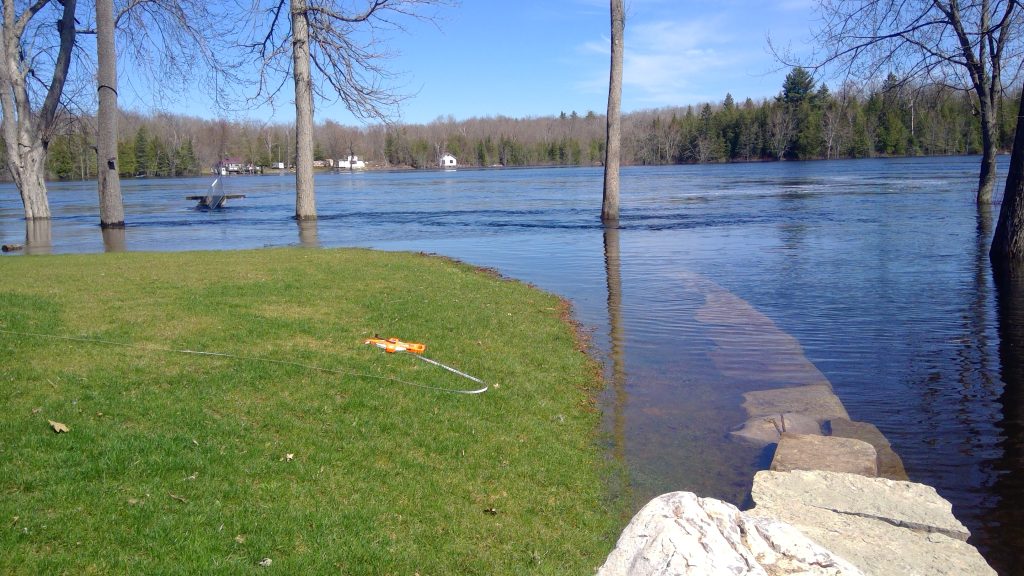
Example of floodwaters exceeding the originally high water mark
Can I see an Example of a completed permit application form?
Staff have completed example permit application forms to assist applicants through the process. Check out these examples:
How do I report a potential violation?
You can report a potential violation by filling out the form below. Check out this web page for more information on non-compliance issues.
Report of Potential Violation Form